You got in a bit ahead of me. Back home as of late Thursday afternoon and resuming the narrative. The full report is gonna take a book.
Yeah, I remember that one. And measurably stupider by the year. Oh well, the crowd with whom I spent the critical hours of the critical day were at least intelligent enough to know that even if it's not possible to actually see the moon during a given day it can be possible to see where it is and its effects.
Relevant traffic stayed virtually nonexistent, weather outlook steady optimal, rolled from Helena at about 03:30, stars shining, onto I-15. About half / two thirds of the way down started noticing that we were becoming a component of a low density parade of eclipsees - zilch northbound, significant southbound.
Stopped off in Dillon to top off and increase the 2017 Corolla's range enough to get us back out of any conceivable nightmare scenario (and they gave it to us at least a couple gallons low).
Sky to the east started lightening, crossed the Continental Divide at least three times - the last being at Monida (Mon(tana)ida(ho)) Pass at 6820 feet. Shortly before then, I think, we started seeing a high cloud layer in dark grey light over the Snake River Plain but it looked thin enough to get burned off quickly and as range and lighting improved it appeared to taper off to the east short of target. A bit thereafter we got our first shot at the unobstructed sun just above the horizon after clearing the end of a ridge.
Got off I-15 at Dubois, we went west on Idaho 22, everybody else went east. Picked up a Golden Eagle and the highest concentration of Redtails I've ever seen, all parked on whatever was available - utility poles, fences, pivot irrigation equipment, ground... Had to keep priorities straight though and get in position and prepped.
Target I'd designated as E(clipse)09. I'd identified road accessible Center of Path points between just before Idaho at Lime, Oregon and just after at Jackson Hole Airport, coded them E27 to E01, and punched them into the GPS receiver so's we could plan and be prepared as best as possible for last gasp cloud dodging.
Specs for same from:
http://xjubier.free.fr/en/site_pages/solar_eclipses/TSE_2017_GoogleMapFull.html
USA - 2017 August 21 Total Solar Eclipse - Interactive Google Map - Xavier Jubier
E09
2017/08/21
43°54'05.93" N 112°47'22.92" W
43.90165°, -112.78970°
(~4940 foot elevation)
2:16.7 (total solar eclipse)
2:17.3 (lunar limb corrected)
Umbral depth - 100.00%
Umbral depth - 0 m (0 ft)
Path width - 105.3 km (65.5 mi)
Obscuration - 100.00%
Magnitude at maximum - 1.01419
Moon/Sun size ratio - 1.02838
Umbral velocity - 0.853 km/s (1908 mph)
Event (ΔT=68.8s) - Altitude - Azimuth - P - V - LC
C1 - 16:14:33.8 - 36.7° - 111.1° - 286° - 13.0
C2 - 17:31:37.0 - 48.5° - 131.1° - 108° - 07.3 - -0.8 s
MX - 17:32:45.3 - 48.7° - 131.5° - 198° - 04.3
C3 - 17:33:53.7 - 48.8° - 131.8° - 288° - 01.3 - -0.2 s
C4 - 18:56:26.0 - 56.9° - 162.9° - 109° - 07.9
Click on a point in the Path on the Jubier site and then click on the
Help in the upper right corner of the resulting box (or just near the upper left corner (
Help) I've subsequently found) for explanations of the terms if interested. Or:
Eclipse type & Duration - The type and duration of the eclipse as seen at your location (taking into account that the Sun may not be above the horizon until the eclipse is in progress, etc.). The corrected duration taking into account the lunar limb profile is displayed only inside the path of totality. Displays "???" if the eclipse is underway at sunrise or sunset.
Umbral/Antumbral depth - The percentage of the way from the edge of the eclipse to the centre line that this location is at.
Path Width - The width of the total or annular path in kilometers.
Obscuration - The percentage of the Sun's disk surface covered at maximum eclipse (this box will display "???" if the Sun is below the horizon at maximum eclipse).
Magnitude at maximum - The fraction of the Sun's diameter covered by the Moon at the local maximum eclipse.
Moon/Sun size ratio - The ratio of the apparent size of the Moon to that of the Sun at the local maximum eclipse.
Umbral/Antumbral velocity - The speed of the umbra/antumbra.
Eclipse diagram - The eclipse diagram displays the relatives positions of the Sun, Moon and ground in horizontal coordinates (the refraction and terrain declivity are not taken into account). The solar north is indicated by the red tick mark and the diagram is updated when hovering the cursor over the various contact events.
Eclipse
Event or sunrise/sunset.
The Universal Time (UT)
Date and
Time of the event (if the event occurs while the Sun is below the horizon, an asterisk (*) will appear after the hour).
Alt - Altitude of the sun. in degrees, above the horizon. To have the value with the atmospheric refraction, hover the cursor over the value for a few seconds to get a tooltip.
Azi - Azimuth of the sun, in degrees (0° = due north, 90° = due east, etc.).
P - Angle, in degrees, between the north point on the Sun's disk and the contact point with the Moon. When the current event is sunrise or sunset, the obscuration of that event is displayed over the two columns when the eclipse is in progress (the time is then rounded to the nearest minute and the atmopsheric refraction not taken into account).
V - The "o'clock" position on the Sun's face of the contact point with the Moon (eg V=12.0 means that the contact point is in the "12 o'clock" position - ie the top of the Sun's disk).
LC - The calculator is able to determine a correction factor to the time of the start and end of the eclipse due to the fact that the Moon's limb is not smooth. When it is, then the correction (in seconds) it has applied is given. A click on the LC column header will display the lunar limb profile and Baily's beads in a new window.

Local / Mountain Daylight Times - UTC-6:
- 10:14:33.8 - start of partial
- 11:31:37.0 - start of total
- 11:32:45.3 - maximum
- 11:33:53.7 - end of total
- 12:56:26.0 - end of partial
Duration of E09 event:
- 02:41:52.2
Bear with me for a dozen Google Earth shots all dead centered on E09 and zooming in progressively with altitudes noted.
Pacific NorthWest plus:
E09 - 01 - 1085.30 miles
http://c1.staticflickr.com/5/4385/36403875850_95d754a2b6_o.png
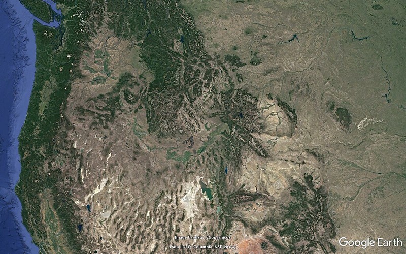
E09 - 02 - 0825.00 miles
Note the U-shaped Snake River Plain bending around the dodging-road unfriendly central Idaho mountains:
http://c1.staticflickr.com/5/4415/36801050975_1b138ae22c_o.png
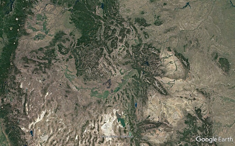
Yellowstone, Continental Divide is just beyond the NE end of the U.
E09 - 03 - 0519.77 miles
http://c1.staticflickr.com/5/4340/36403875630_aa1f3dec28_o.png
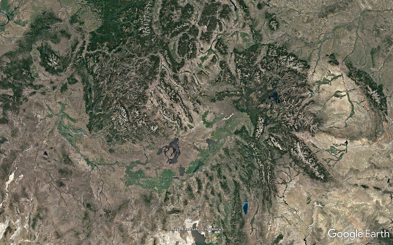
Tetons. Mostly North/South snow covered range south of Yellowstone. Grand Teton is 13770 feet, 8.4 miles from the path on the north, 100.0 miles a bit south of east of E09, on a line with Rexburg (50.1 miles).
E09 - 04 - 0354.17 miles
http://c1.staticflickr.com/5/4370/36801050775_0665b3d301_o.png
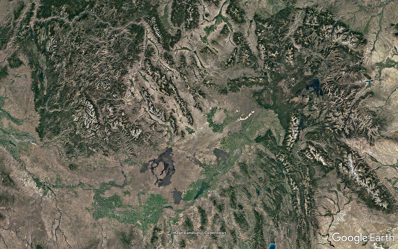
Note the BLM's Saint Anthony Sand Dunes and the Craters of the Moon National Monument - thin white strip north of Rexburg and sprawling dark lava flow SW of Arco, respectively. Borah Peak, high point of Idaho and within the Path 7.36 miles off Centerline on the north side, is just above the point of bulge of the southwesternmost of three rather distinct parallel ranges extending SSW into the northeastern Snake River Plain.
E09 - 05 - 0184.24 miles
http://c1.staticflickr.com/5/4342/36403875450_c6dc2d0426_o.png
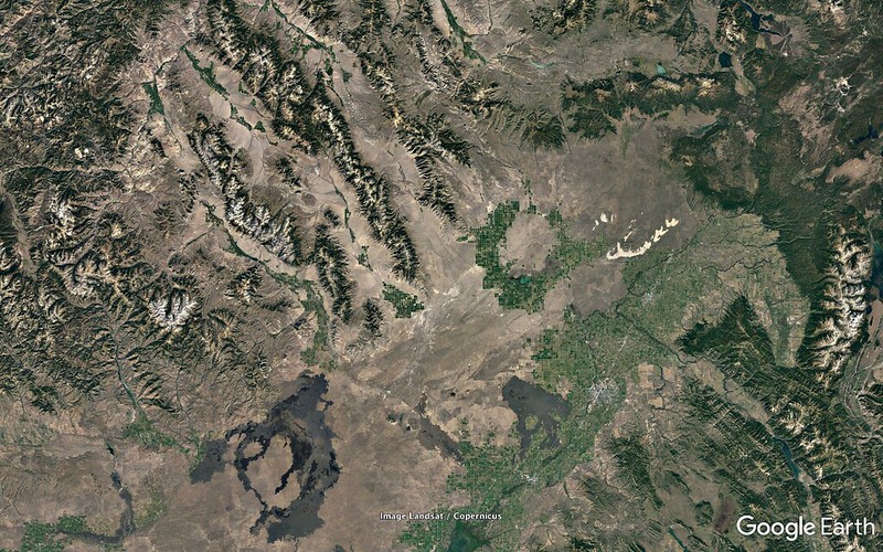
E09 is between a huge circular pivot irrigation area associated with Mud Lake to the east and Saddle Mountain to the west. King Mountain overlooks an extensive pivot irrigation area to its west from a somewhat disjointed south end section of Borah Peak's range.
E09 - 06 - 0073.39 miles
http://c1.staticflickr.com/5/4347/36801050505_a40e84261e_o.png
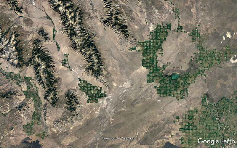
Saddle Mountain, 10810 feet, 8.58 miles from E09.
E09 - 07 - 0039.95 miles
http://c1.staticflickr.com/5/4415/36403875230_1fd54250e9_o.png
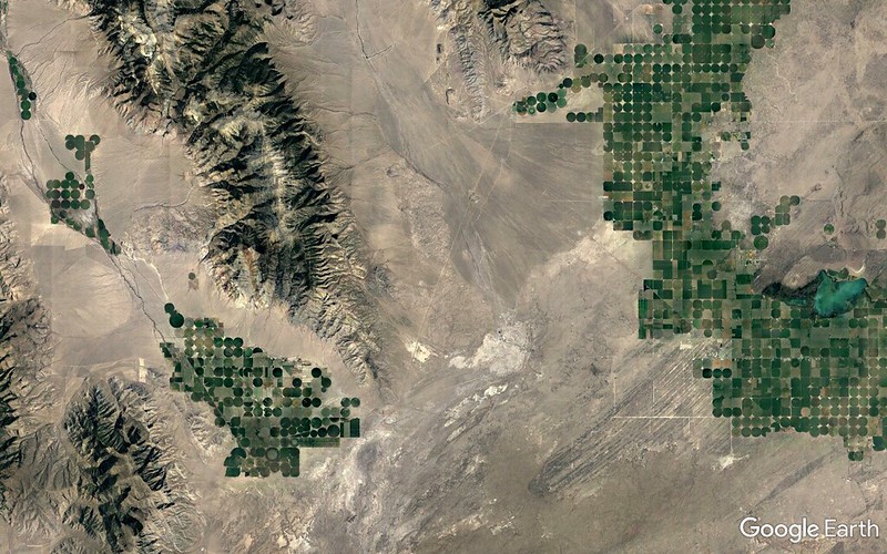
Idaho 22 - NNE/SSW - visible.
E09 - 08 - 0022.64 miles
http://c1.staticflickr.com/5/4431/36801050345_39984c825d_o.png
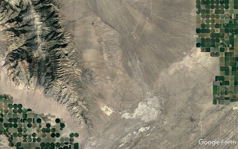
Powerlines running mostly parallel and to the west of Idaho 22.
E09 - 09 - 43782 feet
http://c1.staticflickr.com/5/4370/36403875070_3bf91ee436_o.png
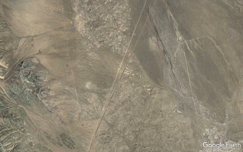
E09 - 10 - 24560 feet
http://c1.staticflickr.com/5/4391/36801050145_b49c58726a_o.png
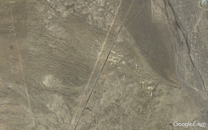
E09 - 11 - 08223 feet
http://c1.staticflickr.com/5/4361/36801049095_7508c15093_o.png
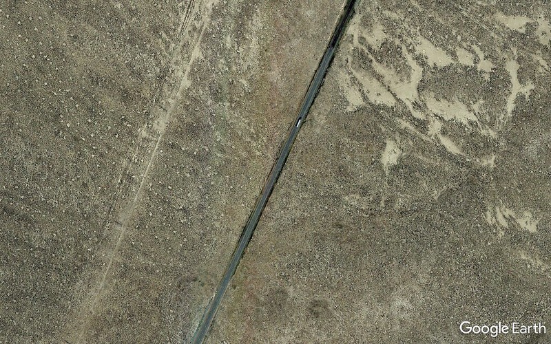
E09 - 12 - 05526 feet
http://c1.staticflickr.com/5/4345/36403873190_2f5c769749_o.png
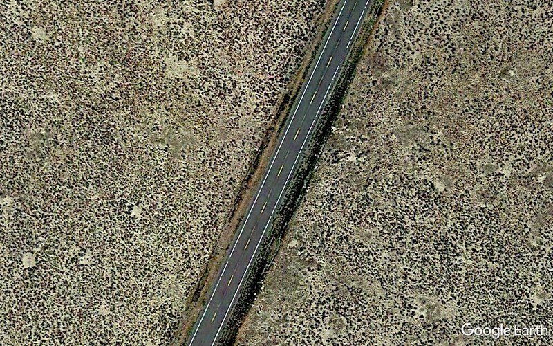
Shoulders had been nicely mowed as a precaution against catalytic converter fires and we started seeing people parked and camped on shoulders and farther off the road as we progressed SW so fears of being booted dissipated fast.
At the junction of Idahos 22 and 28 there's a couple of end-to-end football fields worth of asphalt and we found it only light moderately populated with geeks, cars, Winnebagos, gear, kids, dogs, four porta-potties. Plenty of available space.
Wow! This could be an option! Stopped and talked to a geek unit to get a better feel for the lay of the land. It was tempting but it was still about 6.7 miles and three seconds worth of totality off center and we continued to see if there would be a good reason not to do E09 and turn back.
There wasn't.
Nightmare scenario was bumper to bumper parking both sides radiating miles in both directions out from E09. Reality was maybe a couple hundred loosely scattered individuals along the stretch. Nothing particularly close or tight around what I was able to pinpoint with the GPS.
Shadow of nephew with iPhone at 07:50 with low morning sun lighting ENE face of Saddle Mountain.
01-7108
http://c1.staticflickr.com/5/4424/36652721921_5384bbe6a8_o.jpg
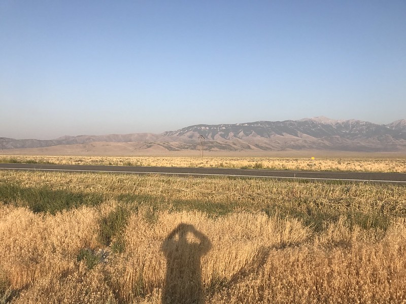
Aforementioned powerline. Clouds, smoke as nonexistent everywhere as in these two photos.
02-7109
http://c1.staticflickr.com/5/4357/36395021500_e941124509_o.jpg
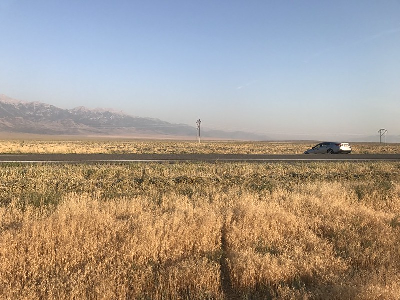
Under two and a half hours to go before things start happening. To be continued...
http://en.wikipedia.org/wiki/Solar_eclipse_of_August_21,_2017
Solar eclipse of August 21, 2017 - Wikipedia

---
Edit - 2017/08/29 16:00:00 UTC
Jubier graphic amended.
